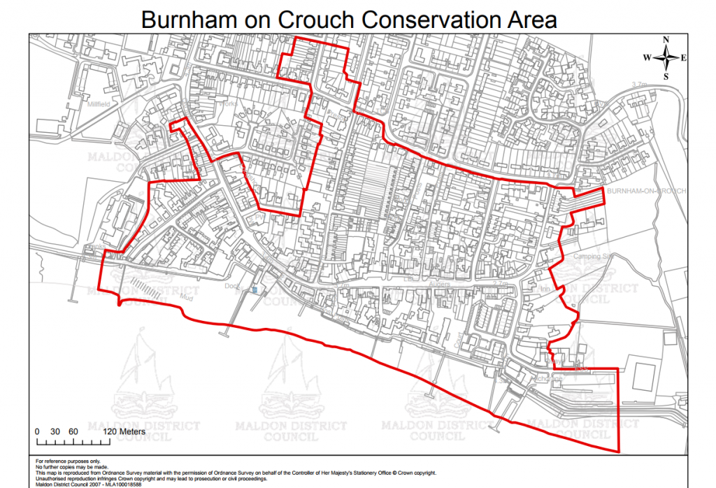
The Burnham on Crouch Conservation Area covers the lower part of town.
The Conservation Area is designed to protect the special architectural and historic interest of the town – those features that make it unique and distinctive.
Conservation areas tend to feature extra planning controls and considerations to protect the historic and architectural elements which make the place special. They are most likely to affect owners who want to work on the outside of their building or any trees on their property.
In Burnham, much of the old town and the waterfront is protected by being a conservation area.
The Burnham Conservation area is bordered by the mean low water line in the River Crouch to the south, the Burnham Sailing Club and the properties on Coronation Road to the west, some of the properties on Station Road (west side) including a number of properties north of Remembrance Avenue, and properties including, and to the south of the Rio Cinema, including High Street properties and Chapel Road properties up to Western Road.
North of Western Road, properties between Albert Road and Dorset Road are within the conservation area, some as far north as Queen’s Road. This enclave includes at least two properties west of Albert Road on Western Road.
The border then heads east, following the southern side of Western Road / Orchard Road and then heading south towards the Royal Corinthian Yacht Club back down to the mean low water mark, including properties on both sides of Silver Road and Belvedere Road.
Conservation Area Inspection Team
Its function is to ensure that that any development preserves the distinctive nature of the existing buildings and protects the special architectural and historic interest of buildings in the conservation area.
It is the Council’s responsibility to check that Conservation Area rules are being obeyed.